
Imagery Desktop
See How Cities Change
Download and analyze historical satellite imagery from 1984 to 2025. Detect urban growth patterns, environmental changes, and community transformations over time.
Key Features
Everything you need to analyze urban change through satellite imagery
Historical Imagery
Access satellite imagery from 1984 to 2025 from Google Earth and Esri Wayback archives
Interactive Map Preview
Preview imagery before download with MapLibre GL-powered visualization
GeoTIFF Export
Export georeferenced GeoTIFF files ready for GIS analysis in QGIS or ArcGIS
Social Media Ready
Create stunning timelapse videos perfect for Instagram, TikTok, YouTube, and other social platforms
Fast & Concurrent
10 parallel download workers with smart epoch fallback for reliable imagery
AI Ready
Export imagery for AI video tools like Sora, Runway, and Kling to generate neighborhood explainers and urban analysis content
See It In Action
Powerful tools for detecting patterns in urban change
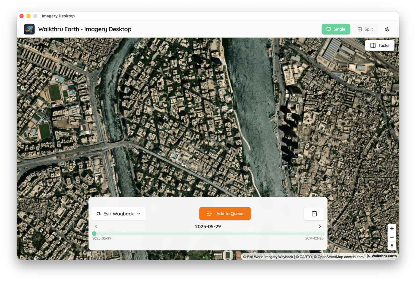
Interactive Map Preview
Browse historical imagery with an intuitive timeline. Select any date from 1984 to 2025 and preview imagery before download.
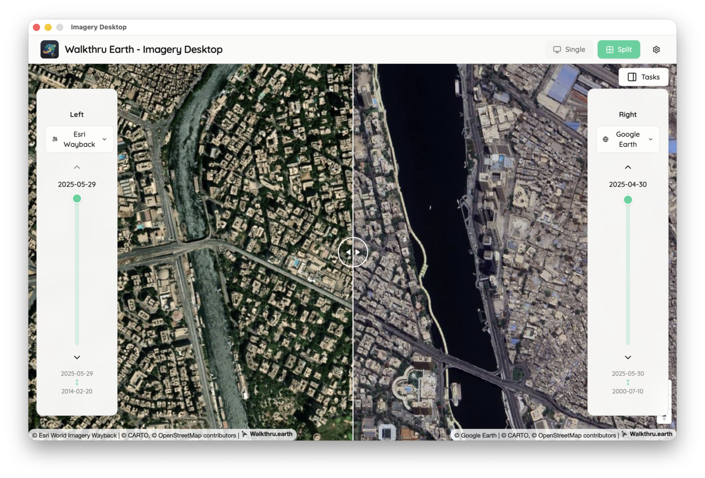
Split View Comparison
Compare imagery side-by-side across different dates. Analyze urban change, development patterns, and environmental shifts with precision.
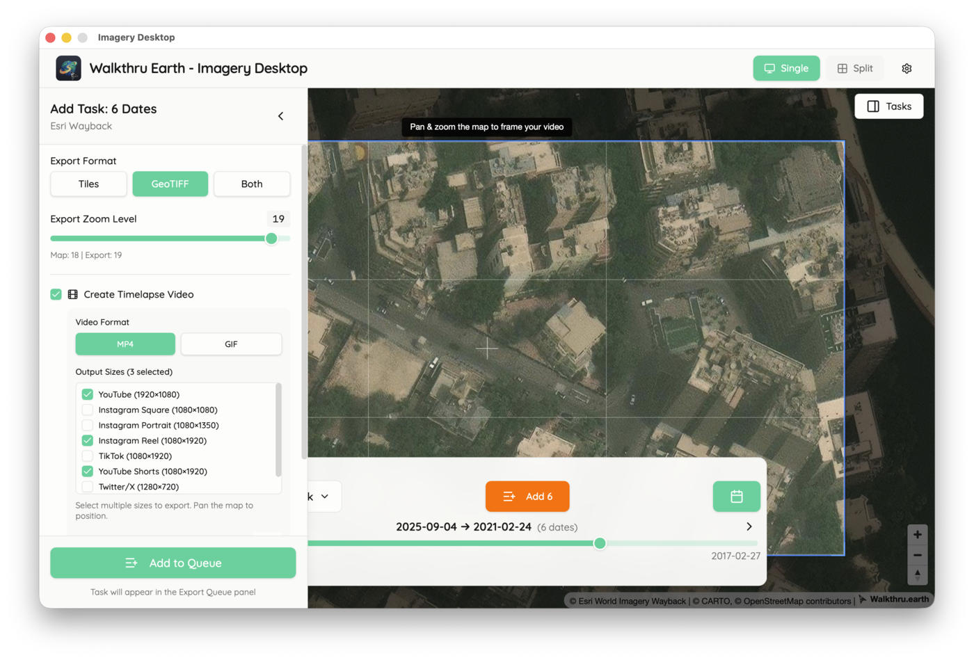
Video Timeline Export
Create stunning timelapses showing urban transformation. Perfect for presentations, social media content, and storytelling on Instagram, TikTok, and YouTube.
Flexible Export Options
Export as GeoTIFF for GIS analysis, tiles for web maps, or videos for storytelling. Choose zoom levels and configure output precisely.
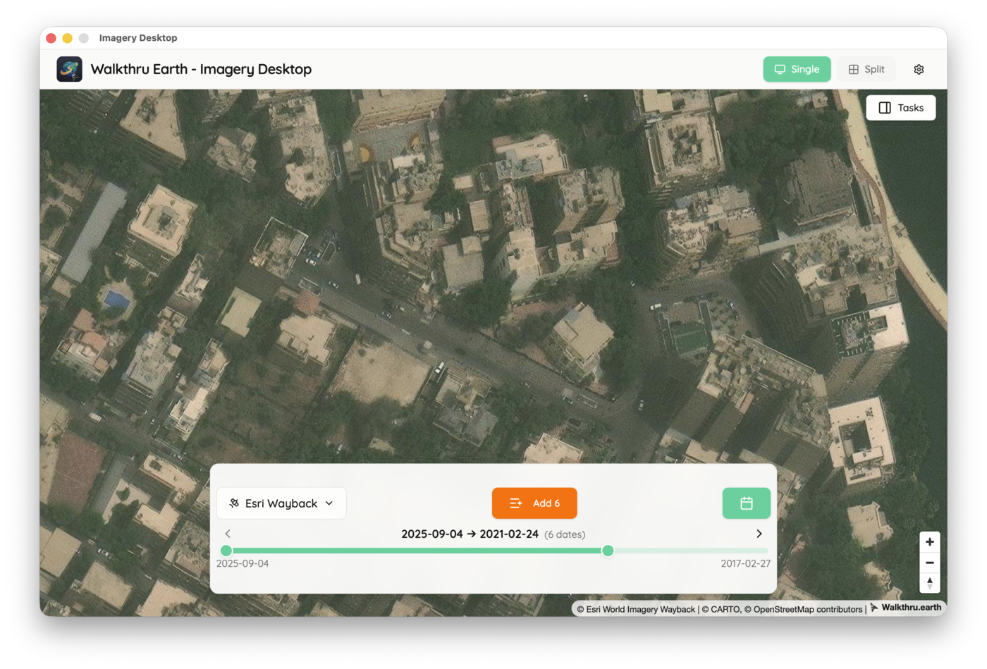
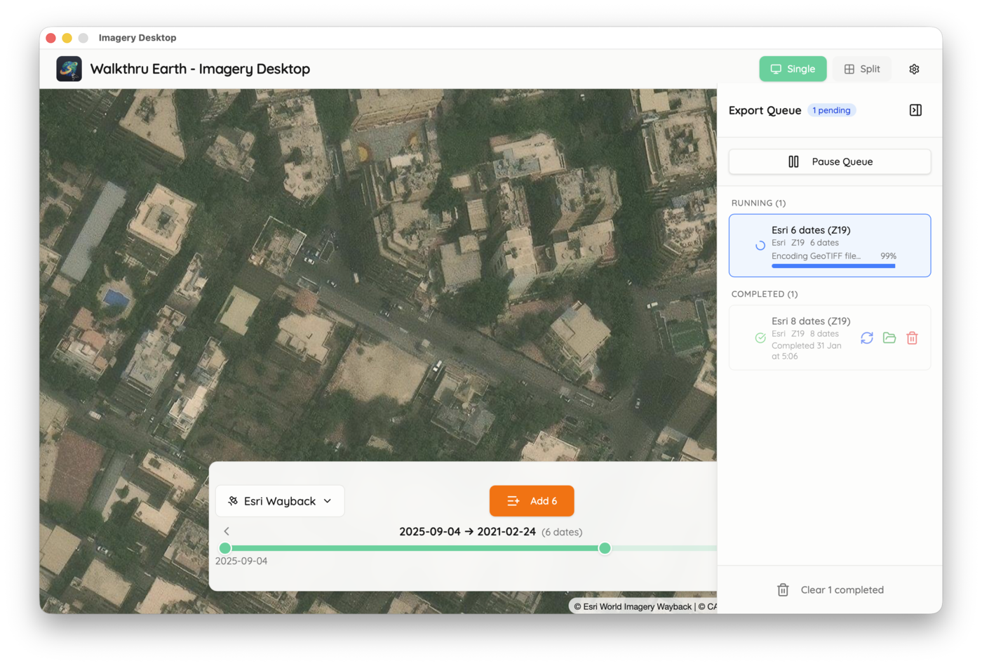
Background Task Queue
Queue multiple exports and let them run in the background. Track progress, manage tasks, and download when ready.
Urban Timelapse
Watch how Imagery Desktop creates stunning timelapses showing urban transformation over time
Esri Wayback timelapse: September 2025 to February 2021
This software is open-source. The satellite imagery accessed through this application remains property of the respective providers (Google Earth, Esri) and their imagery partners. Users are responsible for complying with imagery provider terms of service.